Enhancing Map Design with the Line Topography Elements Set
Creating a visually accurate and engaging map goes beyond simply outlining borders and countries. While defining political boundaries is essential, it's the topography elements that truly bring a map to life. The Line Topography Elements Set offers designers, educators, marketers, and hobbyists an effective way to enhance their cartographic projects with realistic textures and terrain features.
What Is the Line Topography Elements Set?
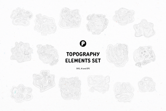
The Line Topography Elements Set is a curated collection of 20 scalable illustrations designed specifically for topographical mapping. Each element uses layered lines to simulate elevation changes, giving the illusion of stepped surfaces that represent hills, valleys, mountains, and other natural formations. These designs are ideal for adding depth and realism to any map project—whether you're illustrating geographical regions, hiking trails, or thematic layouts like fantasy worlds or educational materials.
This set is available in three popular vector formats: AI (Adobe Illustrator), SVG (Scalable Vector Graphics), and EPS (Encapsulated PostScript). This versatility allows users to work within their preferred design software while maintaining high quality and scalability across different platforms and outputs.
Why Use It?
- Professional Quality: Ideal for creating detailed maps for presentations, reports, websites, or print media.
- Design Flexibility: With various contours and shapes, you can customize the look of your map to match specific themes or styles.
- Time Efficiency: Instead of drawing every contour line manually, this set provides ready-made components you can adapt quickly.
- Visual Appeal: Adds texture and dimension, making your map more engaging and easier to interpret.
Common Mistakes When Using Topography Elements
Many users make the mistake of relying solely on country outlines when designing maps. This approach often results in flat, uninteresting visuals that fail to convey the actual geography of the land. Similarly, using only one type of topography element without considering its context can lead to inaccuracies and misinterpretations.
Mistake 1: Ignoring Scale and Proportion
Topography elements must be scaled appropriately to maintain accuracy. If you use them at the wrong size, they may distort the perception of elevation or terrain. For example, placing a mountain symbol too large in a small-scale regional map can overwhelm the layout and confuse viewers about the true landscape.
Better Approach: Always adjust the size of each topography element relative to the overall scale of your map. Test how it looks at different zoom levels if the map will be used digitally.Mistake 2: Overusing or Underusing Elements
Another common error is either overloading the map with too many topography details or not including enough to provide meaningful geographic context. Too much detail can clutter the design, while too little might leave the map feeling incomplete or misleading.
Better Approach: Balance is key. Focus on areas where topography plays a significant role, such as mountainous regions, river basins, or coastal terrains. Use fewer elements in flatter regions to keep the design clean and readable.Mistake 3: Neglecting Layering and Depth
Layered lines are what give topography its visual depth. However, some creators overlook how these lines should be arranged to simulate elevation accurately. Misplaced or overlapping lines can create a confusing representation of the land surface.
Better Approach: Study real-world topographic maps to understand how contour lines behave. Closer lines indicate steeper slopes, while wider spacing shows gentler inclines. Mimic this pattern when arranging your elements.Mistake 4: Not Checking Format Compatibility
The Line Topography Elements Set supports multiple file formats, but not all tools handle these files the same way. Some users download the set and later find out their design software doesn’t support SVG or EPS, leading to unnecessary frustration and wasted time.
Better Approach: Before downloading, verify which format works best with your current workflow. If you're unsure, test the free sample versions provided by the creator or seller to ensure compatibility.How to Choose the Right Topography Elements for Your Project
Selecting the right topography elements depends on the purpose of your map. A hiking trail map requires precise elevation markers and path indicators, whereas a decorative world map might benefit from stylized terrain features.
Consider Your Audience
If your map is for educational purposes, clarity and accuracy are paramount. You’ll want elements that clearly denote changes in elevation and align with standard cartographic symbols. On the other hand, if your goal is aesthetic—like using the elements as background textures—you can afford more creative freedom.
Match the Theme of Your Design
Topography elements come in various styles, from minimalist to highly detailed. Ensure the style of the elements complements the overall theme of your project. A vintage-style map, for instance, might pair well with classic line-based contour patterns rather than modern digital renderings.
Check for Customization Options
Some users assume they have to use the elements exactly as they are. But with vector formats like AI and SVG, you can easily edit colors, line weights, and even combine elements to suit your needs. Don’t hesitate to modify the assets to better fit your design goals.
Practical Tips for Using the Line Topography Elements Set
To get the most out of your topography elements, follow these best practices:
- Start with a Base Map: Begin by laying out the main outlines of countries and continents before adding topography elements. This ensures proper alignment and spatial awareness.
- Use Layers Strategically: Organize your design into layers so you can adjust individual elements without disrupting the entire layout.
- Combine Elements Creatively: Don’t limit yourself to just one element per area. Mixing and matching different textures can add visual interest and realism.
- Test on Multiple Devices: Especially for digital maps, ensure the topography remains legible on both desktops and mobile screens.
- Stay Consistent: Maintain uniformity in line thickness, color schemes, and spacing to avoid a chaotic appearance.
Real-World Examples
A travel blogger creating a guide to the Swiss Alps could use the Line Topography Elements Set to highlight elevation changes along popular hiking routes. By overlaying subtle contour lines and peak markers, the blog post becomes more informative and visually appealing.
An educator preparing a geography lesson might integrate these elements into a student-friendly map showing the Andes or Himalayas. The layered lines help students grasp the concept of elevation without needing complex 3D models.
Meanwhile, a graphic designer working on a logo for a mountaineering brand could pull a single topography shape and incorporate it into the emblem, giving it a grounded, adventurous feel.
Before You Buy or Download
It’s important to evaluate whether the Line Topography Elements Set fits your needs. Here are a few things to check:
- Purpose: Will you use these elements for professional cartography, educational material, or creative design? Make sure the set suits your intended application.
- License Terms: Confirm the licensing conditions if you plan to use the elements commercially or share them publicly. Some sets require attribution or restrict redistribution.
- Resolution and Scalability: Since the elements are vector-based, they’re resolution-independent. However, always confirm the minimum and maximum sizes they can be used effectively at.
- Software Requirements: Know which applications you'll need to open and edit the files. Adobe Illustrator is typically recommended for full customization.
Final Thoughts
The Line Topography Elements Set is a valuable resource for anyone involved in map creation or design. By avoiding common pitfalls like poor scaling, overuse, or ignoring compatibility, you can significantly improve the usability and visual appeal of your maps. Whether you're an entrepreneur showcasing products on location-based infographics, a marketer designing interactive content, or an educator explaining geography concepts, this set provides a solid foundation to build upon.
Investing in a diverse collection of topography elements isn’t just about having more options—it’s about ensuring your maps communicate information clearly and professionally. With thoughtful application, the Line Topography Elements Set can elevate your projects from basic outlines to rich, immersive representations of the world around us.